Hunter's Run Conservancy District
- Hunter’s Run – formed in 1952 (as a result of the 1948 flood in Lancaster)
- Constructed between 1954-1961
- Hunter’s Run structures control 50% of the runoff that goes through Lancaster.
- 8 flood retarding dams
- 20 sediment control structures
- 1.7 miles of channel modification
- 22 bridges
- 8 miles of road
Please Note: The Conservancy Districts are a separate entity from the Soil and Water Conservation District
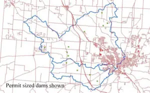
Map of Installed Structures in the North Hocking Watershed